![White full logo.png]](https://help.virto.solar/hs-fs/hubfs/White%20full%20logo.png?height=40&name=White%20full%20logo.png)
Start from the project dashboard
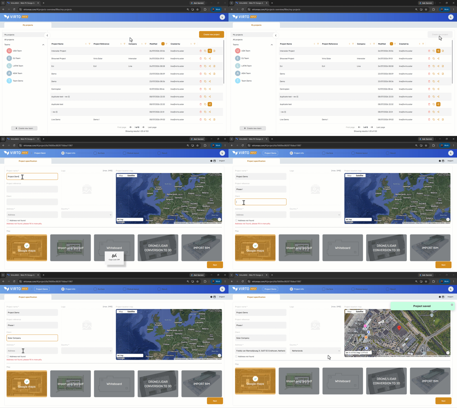
- On the My projects dashboard, select Create new project. To work in a shared workspace, open the relevant team first and create the project there.
- Enter the project name and the available customer or site details.
Choose an underlay
- Google Maps: search for the address and position the site in the map view.

- Image or document: upload a PNG, JPG, or PDF. Set the scale by selecting two points with a known real-world distance, then define the north direction.
- Whiteboard: start from an empty drawing area when no reference image is required.
- Drone or LiDAR conversion: use a converted 3D model when this workflow is available through Virto.RISE. This capability is currently presented as beta functionality.
Confirm the project settings
Review the location, orientation, scale, and unit system before continuing. These inputs affect geometry, solar position, yield, and exported data.
Good to know: A correct underlay is the foundation for every following calculation. When using an uploaded plan, verify at least one second known dimension after scaling.
Next step: Create your surface.